
The DC Triathlon Club is now on RideWithGPS. The site will act as a repository for all of our commonly referred to routes for cycling and running.
All active club members have access to premium navigation features on all club routes and events:
- Voice Navigation in the RideWithGPS mobile app
- Offline Maps in the RideWithGPS mobile app
- PDF Maps + Cuesheets
- Advanced Turn Notifications with TCX files
- Estimated time
Sign up for your FREE RideWithGPS account and get access to all the above features for all of our routes!
Cue Sheet Printing Instructions
- For RideWithGPS links: Cue sheet is on left hand side of the RWG page. Select the option to Print. Scroll to the bottom of the new popup window and select Print. We recommend using the 2 pages per sheet option when printing.
- For MapMyRide links: coming soon.
- For Strava links: coming soon.
Cycling Routes
Washington DC Routes
1-19 Miles
20-40 Miles
40-60 miles
60-80 miles
80+ miles
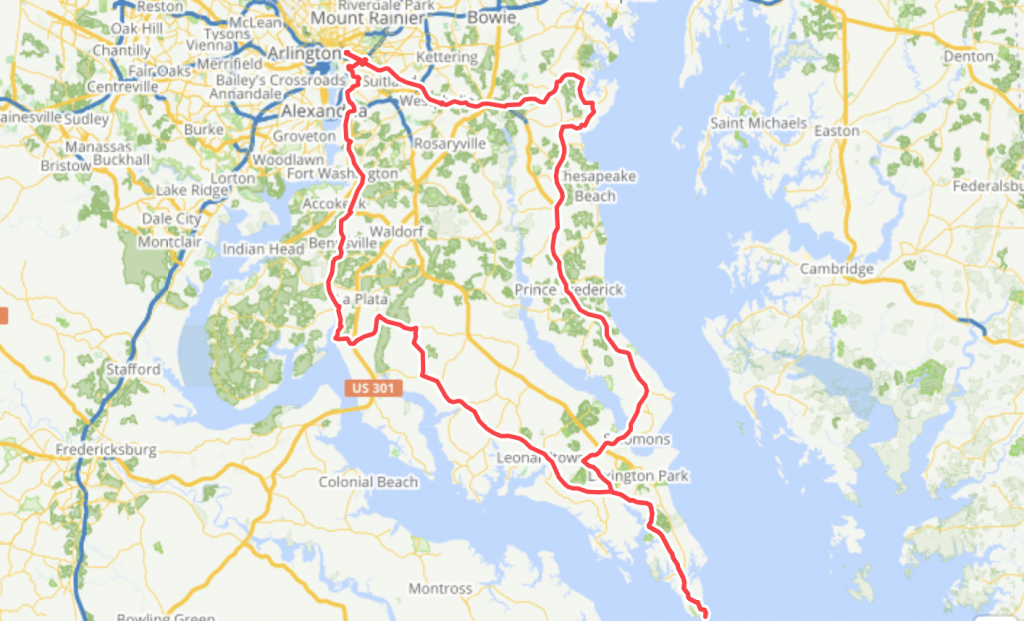
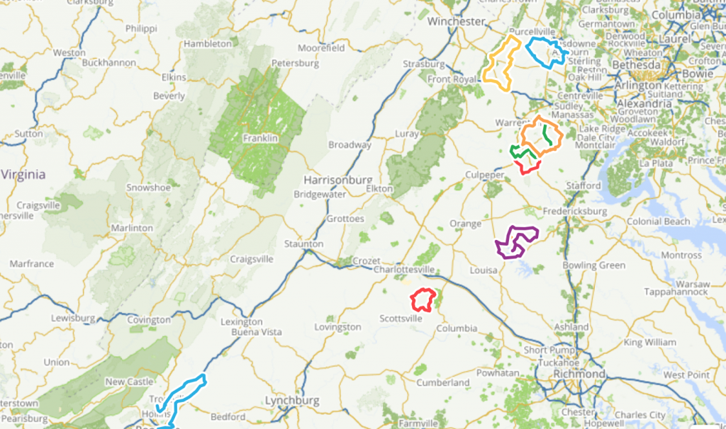
Virginia Routes
1-19 Miles
20-40 Miles
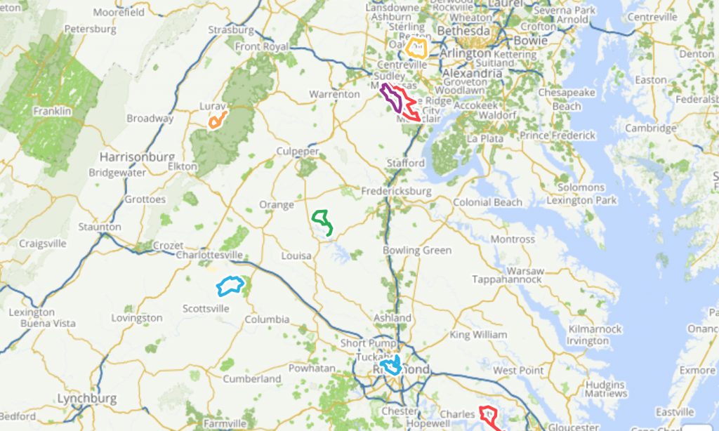
40-60 miles
60-80 miles
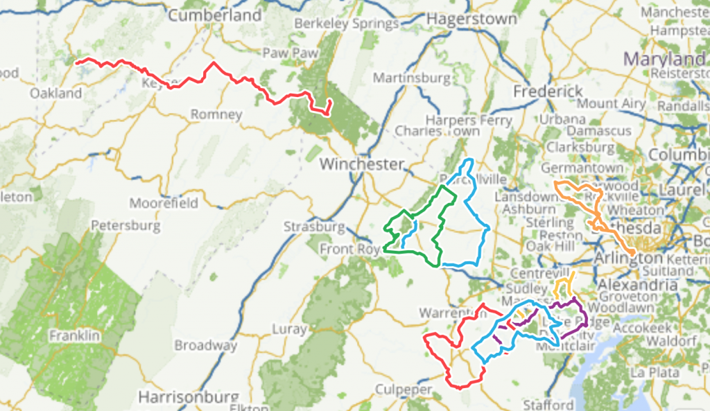
80+ miles
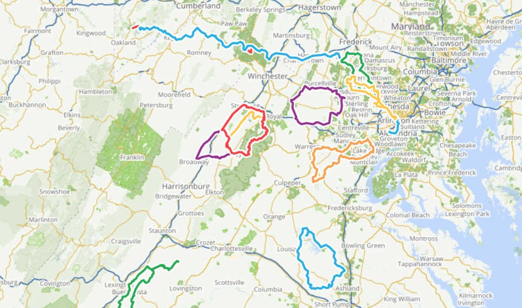
Maryland Routes
1-19 Miles
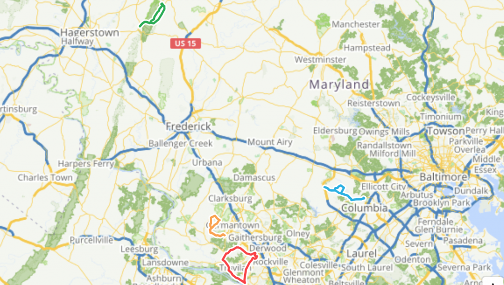
20-40 Miles
40-60 miles
60-80 miles
80+ miles
Running Routes

Washington DC Routes
1-5 Miles
- Hains Point Loop - 3 Mile Route
- Start: East Potomac Golf Course
- Type: Road
- Terrain: Flat
5-10 miles
- Coming Soon
10-15 miles
- Coming Soon
15-20 miles
- Coming Soon
20+ miles
- Coming Soon
Virginia Routes
1-5 Miles
- Coming Soon
5-10 miles
- Potomac Loop - 8 Mile Route
- Start: Gravelly Point Parking Lot
- Type: Path
- Terrain: Flat
10-15 miles
- Coming Soon
15-20 miles
- Arlington Triangle - 16 Mile Route
- Start: Roosevelt Island Parking Lot
- Type: Path
- Terrain: Hilly
20+ miles
- Coming Soon
Maryland Routes
1-5 Miles
- Gaithersburg - 4 Mile Route
- Start: Kentlands Market Square
- Type: Path
- Terrain: Hilly
- Gaithersburg - 5 Mile Route
- Start: Kentlands Market Square
- Type: Path
- Terrain: Hilly
5-10 miles
- Gaithersburg - 6 Mile Route
- Start: Kentlands Market Square
- Type: Path
- Terrain: Hilly
- Gaithersburg - 7 Mile Route
- Start: Kentlands Market Square
- Type: Path
- Terrain: Hilly
- Gaithersburg - 9 Mile Route
- Start: Kentlands Market Square
- Type: Path
- Terrain: Hilly
10-15 miles
- Millennium Trail - 10.5 Mile Route
- Start: Falls Grove Shopping Center
- Type: Path
- Terrain: Hilly
15-20 miles
- Coming Soon
20+ miles
- Coming Soon
Mountain Bike (or Running) Trails
Washington DC Trails
1-?? Miles
- ♥ Rock Creek Park
- Trails: see park trail map
- Type: Trail
- Terrain: Flat/Hilly
Virginia Trails
1-15 Miles
- Wakefield Park
- Start: Recreation Center parking lot
- Sample trails: view on Strava
- Type: Trails
- Terrain: Beginner friendly, some rocks, roots, few climbs.
- Notes: Not good after rains (other parks dry/drain faster). You can also run/bike south towards Lake Accotink Park
- Lake Accotink Park
- Start: park by the dam or at the end of Danbury Forestry Dr (trail entrance)
- Sample workout: see on Strava
- Type: Trails
- Terrain: Flat/Hilly
- Notes: Trail along the creek and north of lake is partly paved partly gravel, all flat. Trails west of the lake are hilly and technical.
Maryland Trails
1-15 Miles
- Rosaryville State Park -
- Start: Perimeter trail parking lot
- Sample workout: see 10 miler on Strava
- Type: Trails
- Terrain: Rolling/Hilly
- Notes: Sample workout shows Perimeter trail and inner loop trail
Adding Routes
If you have a favorite route that you want to share with club members, please create a PUBLIC route in any of the following interfaces:
Once you have created the route, please email a link to the route to training@dctriclub.org with the following information included in the email:
- Route category: Cycling or Running
- Direct link to the route
- Landmark near the starting point (For example: PNC Bank Georgetown, Marshall VDOT Parking Lot, etc.)
- Google map link to the landmark starting point
- Type of route (Road, trail, mixed [see above for definitions])
- Type of terrain (Flat, hilly, etc. [see above for definitions])